
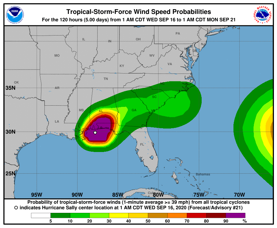
Hurricane Sally Intermediate Advisory Number 21A
NWS National Hurricane Center Miami FL AL192020
700 AM CDT Wed Sep 16 2020
…HURRICANE-FORCE WINDS OCCURRING IN PENSACOLA FLORIDA…
…CATASTROPHIC AND LIFE-THREATENING FLOODING LIKELY ALONG PORTIONS OF THE NORTHERN GULF COAST…
Forecast Discussion from NHC
RAINFALL: Through this afternoon, Sally will produce additional rainfall totals of 8 to 12 inches with localized higher amounts possible along and just inland of the central Gulf Coast from west of Tallahassee, Florida to Mobile Bay, Alabama. Storm totals of 10 to 20 inches to isolated amounts of 35 inches is expected. Historic and catastrophic flooding is unfolding. In addition, this rainfall will lead to widespread moderate to major river flooding.Sally is forecast to turn northeastward after making landfall today and move across the Southeast through Friday, producing the following rainfall totals:
Southern and central Alabama to central Georgia: 4 to 8 inches, with isolated maximum amounts of 12 inches. Significant flash and urban flooding is likely, as well as widespread minor to moderate flooding on some rivers.
Western South Carolina into western and central North Carolina: 4 to 6 inches, with isolated maximum amounts of 9 inches. Widespread flash and urban flooding is possible, as well as minor to moderate river flooding.
Southeast Virginia: 2 to 5 inches, with isolated maximum amounts of 7 inches. Scattered flash and urban flooding is possible, as well as scattered minor river flooding.
STORM SURGE: The combination of a dangerous storm surge and the tide will cause normally dry areas near the coast to be flooded by rising waters moving inland from the shoreline. The water could reach the following heights above ground somewhere in the indicated areas if the peak surge occurs at the time of high tide…


