
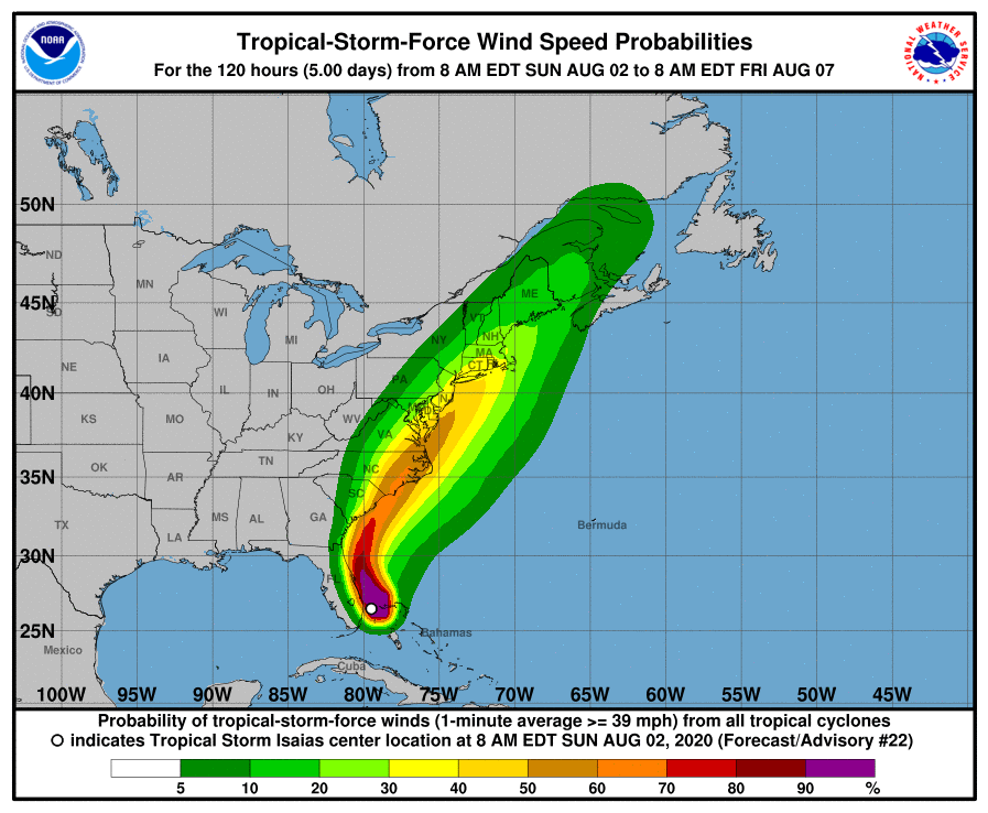
CHANGES WITH THIS ADVISORY: A Tropical Storm Warning has been issued from South Santee River South Carolina to Surf City North Carolina. A Tropical Storm Watch has been issued for the North Carolina coast from north of Surf City to Duck, including Pamlico and Albemarle Sounds. The Tropical Storm Warning south of Jupiter Inlet Florida and for Lake Okeechobee has been discontinued. The Storm Surge Watch for the Florida east coast has been discontinued.
SUMMARY OF WATCHES AND WARNINGS IN EFFECT: A Storm Surge Watch is in effect for… * Edisto Beach South Carolina to Cape Fear North Carolina A Tropical Storm Warning is in effect for… * Jupiter Inlet Florida to Surf City North Carolina
A Tropical Storm Watch is in effect for… * North of Surf City to Duck North Carolina * Pamlico and Albemarle Sounds Interests elsewhere along the mid-Atlantic coast of the United States should monitor the progress of Isaias.
Additional watches or warnings may be required later today. A Storm Surge Watch means there is a possibility of life- threatening inundation, from rising water moving inland from the coastline, in the indicated locations during the next 48 hours.
A Tropical Storm Warning means that tropical storm conditions are expected somewhere within the warning area, generally within 36 hours.


