Meteorologists are warning states throughout the Southeast and Mid-Atlantic that Hurricane Laura (now Tropical Storm Laura) will take a probable path through parts of Tennessee, Kentucky, West Virginia, and Virginia on Friday and into Saturday and Saturday night.
Heavy rain, gusty winds, and isolated tornadoes may be possible as the storm makes its way on land. Winds of 50 mph could bring down trees and 3-7 inches of rain could fall in isolated areas, causing flooding, according to the National Hurricane Center says.
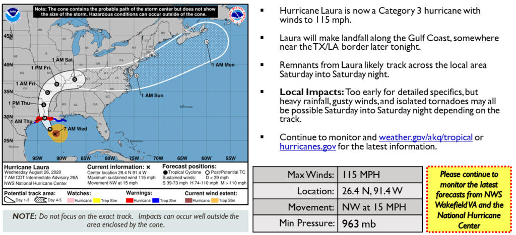
Hurricane Laura came ashore as a Category 4 hurricane in Cameron, Louisiana at 2 a.m. Thursday with wind gusts up to 130 mph and a storm surge over nine feet. It was the strongest hurricane to hit southwestern Louisiana in recorded history.
“Through Saturday, Laura is expected to produce 1 to 3 inches with isolated maximum amounts of 5 inches across the mid-Mississippi Valley and