
From WYFF
Charleston and the Upstate to feel impacts Monday with 1-3 inches of rain possible in the Upstate
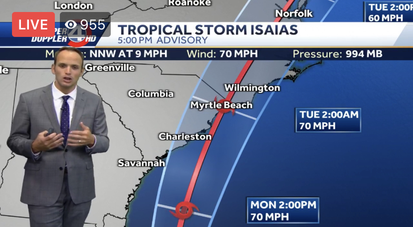
Key Messages: 1. There is the danger of life-threatening storm surge inundation of 2 to 4 feet above ground level from Edisto Beach South Carolina to Cape Fear North Carolina along the immediate coastline and adjacent waterways. Life-threatening storm surge is possible along the North Carolina coast from Cape Fear to Duck. Residents in these areas should follow advice given by local emergency officials.
2. Tropical storm conditions will spread northward within the Tropical Storm Warning area from Florida to North Carolina through Monday night. Isaias is expected to be near hurricane strength when it reaches the coast of northern South Carolina and southern North Carolina Monday night, and strong tropical storm force winds are likely with hurricane conditions possible in the Hurricane Watch area.
3. Heavy rainfall from Isaias will continue to result in potentially life-threatening flash flooding in the Northwest Bahamas through tonight. Flash and urban flooding, some of which may be significant in the eastern Carolinas and the mid-Atlantic, are expected through midweek along and near the path of Isaias across the U.S. East Coast. Widespread minor to isolated moderate river flooding is possible across portions of the Carolinas and the mid-Atlantic.
4. A tropical storm watch is in effect for the U.S. mid-Atlantic coast, including the Chesapeake Bay, Delaware Bay, and Long Island Sound, as tropical storm force winds are possible in these areas on Tuesday and Tuesday night. Additional watches and warnings will likely be issued tonight and Monday as Isaias is expected to move northward near or over the mid-Atlantic and New England states Tuesday and Wednesday.


