
There’s no question that the tropics are churning out storms and tropical waves left and right, especially recently as we now are in the peak of hurricane season.
Your 10 Weather team has been busy this week, keeping an eye on two disturbances in the tropics, one in the western Atlantic and another that will drift into the eastern Atlantic soon. And yes, this is in addition to two named tropical storms, Paulette and Rene, which you can find out more about here.
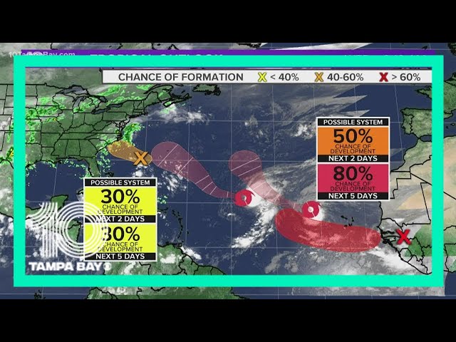
But let’s focus on Disturbances 1 & 2:
Disturbance 1, also classified as Invest 94-L, is an area of low pressure located more than 300 miles southeast of North Carolina. It is producing relatively minimal and disorganized showers and thunderstorms, but some slow development is possible between Wednesday and Thursday as it moves to the west-northwest and heads inland through eastern North Carolina by Thursday afternoon.


