
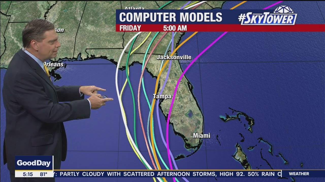
Tropical Storm Elsa’s impacts around Tampa Bay Tuesday night could be very similar to Eta from last year if Elsa tracks near the center of the current forecast cone from the National Hurricane Center.
There is a risk of tropical storm conditions and storm surge impacts along the coasts of Georgia and the Carolinas Wednesday and Thursday.
National Hurricane Center Forecast
NWS National Hurricane Center Miami FL       AL052021
500 AM EDT Mon Jul 05 2021<br>

Elsa appears to be holding steady in strength while moving just
south of central Cuba.  Radar data from Cuba and satellite images
show a persistent area of deep convection over the center and some
banding features, especially on the south side of the circulation.
An ASCAT pass from around 0130Z indicated that Elsa was a compact
system with tropical-storm-force winds mostly confined to a region
within about 60 n mi east of the center. Peak winds in the pass were
around 50 kt in the northeastern quadrant, and given the small size
of the cyclone and somewhat course resolution of the ASCAT data, it
seems very reasonable that Elsa has an initial intensity of around
55 kt.  This intensity estimate is also in line with the latest
Dvorak classifications. The NOAA Hurricane Hunters will be
investigating Elsa again shortly, and the data the plane collects
will be valuable in assessing the storm's intensity and wind field.<br>

The tropical storm is moving northwestward at about 12 kt on the
southwestern periphery of a subtropical ridge located over the
central Atlantic.  A gradual turn to the north is expected over the
next day or two as Elsa moves in the flow between the ridge and a
mid- to upper-level low over the northern Gulf of Mexico.  This
steering pattern should take the core of Elsa across central or
western Cuba later this morning, near the Lower Florida Keys tonight
or early Tuesday, and then along or very near the west coast of
Florida later on Tuesday through early Wednesday.  Most of the
models show Elsa moving inland over west-central or northern
Florida, but given the expected parallel motion to the coast, much
of the west coast of the state will likely see impacts from Elsa on
Tuesday and into Wednesday.  After Elsa clears Florida, it is
expected to move faster north-northeastward across coastal Georgia
and the Carolinas Wednesday and Thursday before moving over the
western Atlantic.  The new track forecast is just a little to the
left of the previous one to be in better agreement with the latest
consensus models.<br>

Given the overall favorable environmental conditions, Elsa could
strengthen a little before it reaches the coast of Cuba later this
morning.  Some weakening is expected due to the land interaction
with Cuba, but most of the model guidance suggests that Elsa could
restrengthen slightly before it moves inland over Florida.
Significant strengthening is not anticipated though due to moderate
wind shear.  However, it should be noted that given the expected
track, much of the west coast of Florida will be on the east side of
Elsa, which is where the strongest winds, highest surge, and
heaviest rains are expected to be.  Gradual weakening is forecast
while Elsa moves across portions of the southeast U.S., but some
restrengthening is possible again when the storm moves over the
western Atlantic.  The NHC intensity forecast is a little higher
than the previous one while Elsa is expected to be over the Gulf of
Mexico, and it lies near the high end of the model guidance.<br>


