
Learn more at nhc.noaa.gov
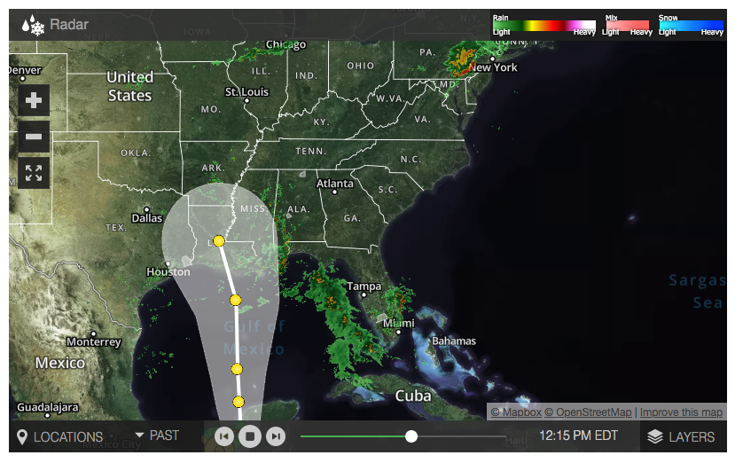
Tropical Storm Cristobal: Latest maps, radar
Cristobal formed as a Tropical Storm on Tuesday June 2, 2020
At 100 PM CDT (1800 UTC), the center of Tropical Storm Cristobal was
located near latitude 18.4 North, longitude 91.9 West.  Cristobal is
moving toward the south-southeast near 3 mph (6 km/h), and a turn
toward the east is expected later today.  A turn toward the
north-northeast and north is expected on Thursday and Friday. On the
forecast track, the center will move over the land mass of eastern
Mexico through Thursday.  The center is forecast to move back over
the Gulf of Mexico by Friday.

Maximum sustained winds are near 50 mph (85 km/h) with higher
gusts.  Slow weakening is forecast during the next 48 hours, and
Cristobal will likely become a tropical depression by Thursday
evening.  Some re-strengthening is expected to begin on Friday.

Tropical-storm-force winds extend outward up to 60 miles (95 km)
from the center.  A wind gust of 55 mph (89 km/h) was reported at
Ciudad del Carmen during the past few hours.

The estimated minimum central pressure is 996 mb (29.41 inches).
Cristobal is forecast to re-emerge over the southern Gulf of
Mexico Friday or Friday night and move northward over the central
and northern Gulf of Mexico over the weekend.  There is a risk of
storm surge, heavy rainfall, and wind impacts beginning over the
weekend along portions of the U.S. Gulf Coast from Texas to the
Florida Panhandle.  While it is too soon to determine the exact
location, timing, and magnitude of these impacts, interests in these
areas should monitor the progress of Cristobal and ensure they have
their hurricane plan in place.

More Posts You Will Enjoy …
[catlist name=”iongreenville”]


