Thursday Morning update: The system promising severe weather is moving in the area earlier this morning than originally forecasted. While this means that the risk has gone down a little, it certainly doesn’t mean we won’t see any severe weather; it just means the risk is more limited.
Visit UpstateWeather.com/stormcenter for the latest on the threat.
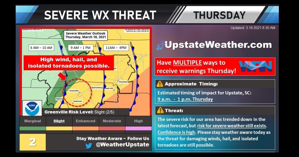
TIMING
It’s important to stay vigilant this morning and early afternoon. For the Greenville-Greer-Spartanburg areas, the timing of the most severe weather will be between 9am – 1pm.
THREAT
Again, don’t get hung up on the “risk trending down” theme here – please stay weather aware today as the threat still exists for:
- Damaging Winds are the main threats
- Large Hail is possible
- Isolated Tornadoes can’t be ruled out, especially along and south of I-85
Follow @weatherupstate on Twitter for the latest warnings, watches, & advisories.
BE WEATHER AWARE
Forecast confidence is high today. Throughout the day, continue to monitor the latest forecasts over the next 24 hours AND listen to the TV EXPERTS – they are trained to save lives!
We urge everyone to have MULTIPLE ways to receive warnings today:
- BEST: NOAA Weather Radio, ON w/battery backup
- Turn on Wireless Emergency Alerts (on SmartPhones)
- In Greenville County, sign up for Code Red Alerts
- Download any of the Local TV/News Apps on your Smartphone