
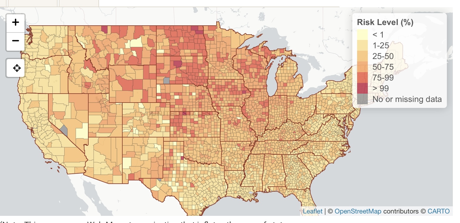
This real-time map shows the risk level of attending an event, given the event size and location.
The risk level is the estimated chance (0-100%) that at least 1 COVID-19 positive individual will be present at an event in a county, given the size of the event.
View the Map

COVID-19 Event Risk Assessment Planning Tool
(Note: This map uses a Web Mercator projection that inflates the area of states in northern latitudes. County boundaries are generalized for faster drawing.)


