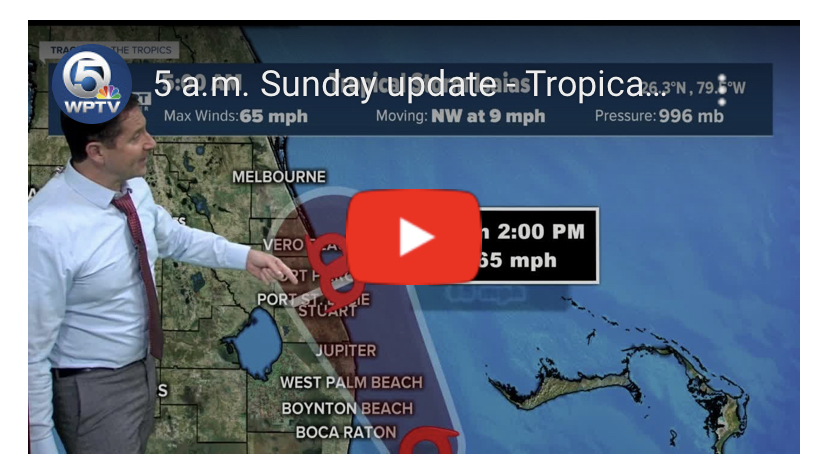
5am Update
Key Messages:
1. Tropical storm conditions will continue across portions of the northwestern Bahamas through today.
2. Tropical storm conditions are expected to spread northward along the east coast of Florida within the warning area through early Monday. These conditions are expected to spread northward along the coast of Georgia and South Carolina within the warning area on Monday.
3. Dangerous storm surge is possible along the Florida east coast from Jupiter Inlet to Ponte Vedra Beach where water rises of 2 to 4 feet above ground level are possible along the immediate coastline and adjacent waterways. Residents there should follow advice given by local emergency officials.
4. Isaias will produce heavy rains and potentially life-threatening flash flooding across portions of the northwestern Bahamas, and flash and urban flooding, especially in low-lying and poorly drained areas, along the East Coast of the United States. Minor to isolated moderate river flooding is possible across portions of the Carolinas and Mid-Atlantic this week.
5. Tropical storm watches are in effect for portions of the coast of South and North Carolina. Additional watches and warnings will likely be issued later today as Isaias is expected to move northward near or over the southeast and mid-Atlantic coasts over the next couple of days.
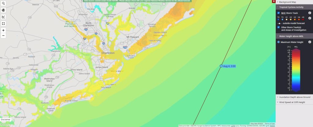
Storm Surge a Threat to. Charleston And Myrtle Beach
The storm arrives during a high tide Monday in the charleston area. This could lead to a 5-8 foot storm surge in the area.
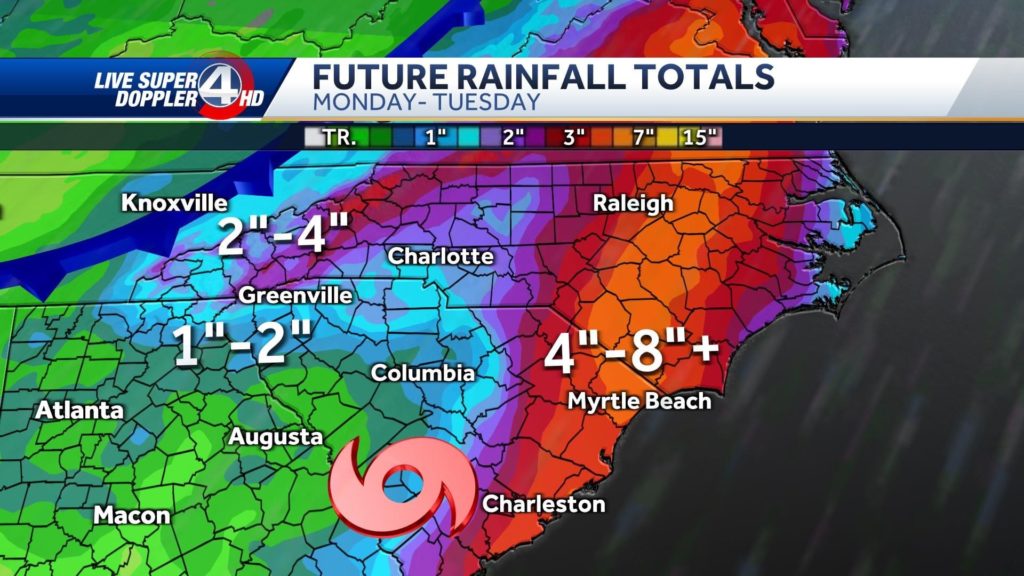
Isaias Brings Rain to the Upstate
Rain will be a major issues from Isais. Here are the projected storm totals for the area. From WYFF. Greenville is looking at potentially 1-2 inches of rain Monday into Tuesday.