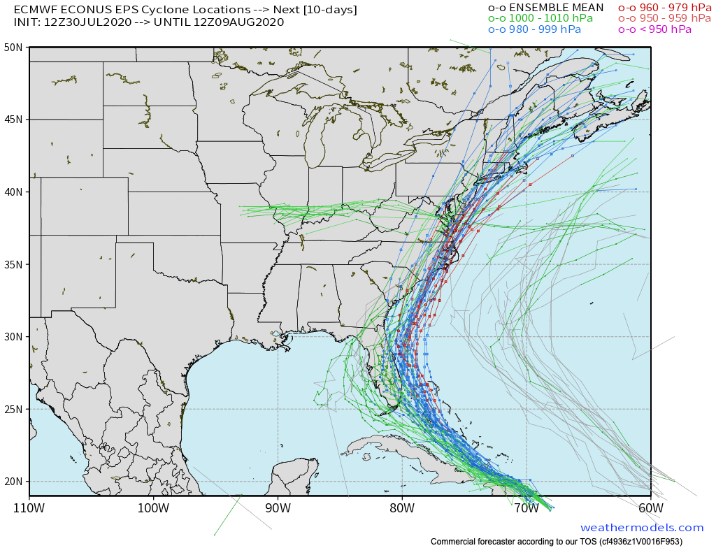
Strengthening is expected during the next day or so while the hurricane remains over the very warm waters near the Bahamas with reasonably low vertical shear. The forecast for the first 24 hours has been raised from earlier, at the top of the guidance spread. Increasingly southwesterly flow aloft should cause an increase in shear over the weekend, which is forecast by most of the guidance to lead to a gradual decrease in intensity. The details are not very clear at all, especially considering the track uncertainty, but there is a notable chance of a hurricane moving close to the U.S. East coast, so the forecast continues to show that scenario.
The Latest From Chris Justus

Hurricane Isaias Forecast Discussion
Key Messages:
1. Isaias will produce heavy rains and potentially life-threatening flash flooding and mudslides across the Dominican Republic, northern Haiti, Turks and Caicos, and the Bahamas. Heavy rains associated with Isaias may begin to affect South and east-Central Florida beginning late Friday night, and the eastern Carolinas by early next week, potentially resulting in isolated flash and urban flooding, especially in low-lying and poorly drained areas. Isolated minor river flooding is possible in the Carolinas early next week.
2. Hurricane conditions and dangerous storm surge are expected in portions of the Bahamas today and Saturday, and Hurricane Warnings are in effect for these areas. Preparations to protect life and property should be rushed to completion.
3. Tropical storm conditions are possible along portions of the Florida east coast beginning Saturday, and a Tropical Storm Watch remains in effect. While storm surge watches are not currently needed for this area, they may be required later today if the forecast track shifts closer to the coast. Heavy rains associated with Isaias may begin to affect South Florida and east-Central Florida beginning late tonight, potentially resulting in isolated flash and urban flooding, especially in low-lying and poorly drained areas.
4. There is a risk of impacts from winds, heavy rainfall, and storm surge late this weekend from the northeastern Florida coast and spreading northward along the remainder of the U.S. east coast through early next week. The details of the track and intensity forecast remain uncertain, and it is too soon to determine the magnitude and location of these potential impacts, but interests along the entire U.S. east coast should monitor the progre
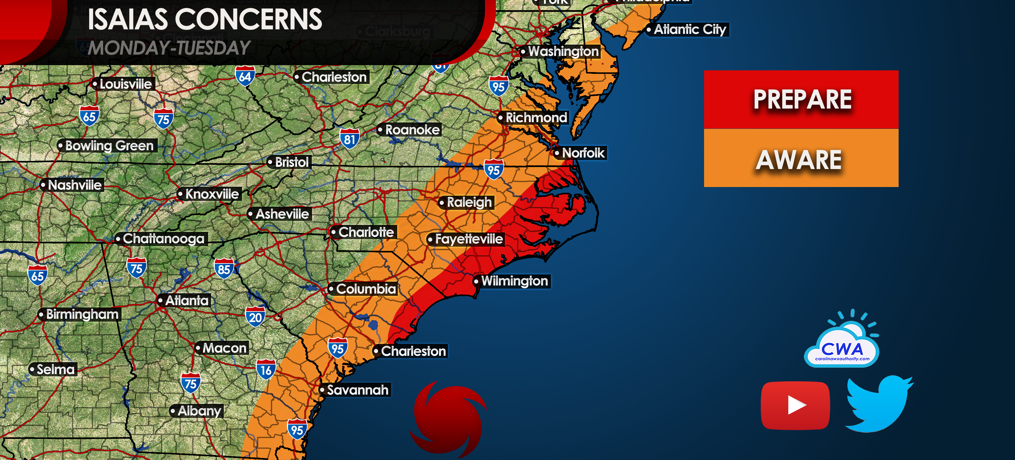
What we currently think is that residents along the NC coast and even SC coast should begin their preparations as the power may be out for quite some time. Also, flooding is also a threat with this storm. Again, intensity is widely unknown so we have to assume the worst will happen. Eastern NC including Wilmington should expect at least a Category 1 hurricane from Sunday into Monday.
carolinawxauthority.com
Read Full Story at carolinawxauthority.com