
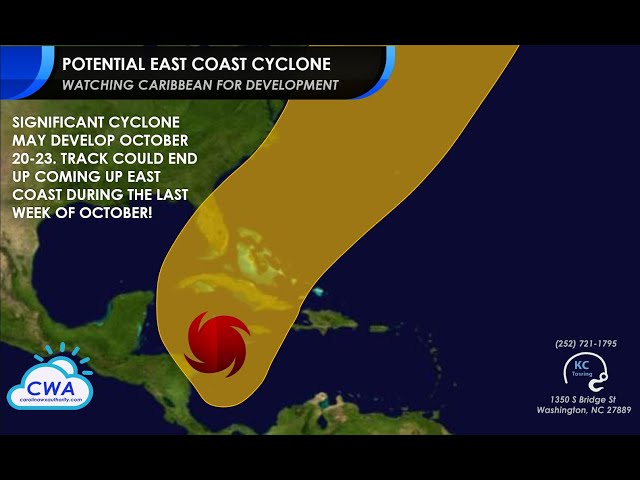
Reliable models continue to show a potential threat to the western Caribbean next week, with a track northeastward that could impact the Bahamas, Bermuda, or even the East Coast before Halloween. We also have a disturbance east of the islands to keep an eye on for a small window of development today.
Tropical Weather OutlookNWS National Hurricane Center Miami FL
200 PM EDT Tue Oct 13 2020
For the North Atlantic…Caribbean Sea and the Gulf of Mexico:
1. A broad area of low pressure associated with a tropical wave is located about 400 miles east of the Windward Islands. Although the low continues to produce an area of showers and thunderstorms, that activity remains confined to the east of the center due to strong upper-level winds. In addition, recent satellite data indicate that the circulation is a little less defined than it was yesterday. Some slight development of this system is still possible today while it moves westward to west-northwestward, but upper-level winds are expected to become even less favorable for development tonight and Wednesday.
* Formation chance through 48 hours…low…20 percent.
* Formation chance through 5 days…low…20 percent.


